Data is everywhere, but if it's not fresh, accurate and contextual, it could be junk data that slows down decision-making, provides false insights and muddies the water. In the world of large fleet management, location data is the nexus between all other data points, providing the context that ties everything together and makes information actionable.
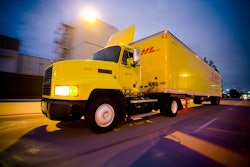
Whether an organization collects residential waste in a big city, transports commercial loads from manufacturing plants to warehouses cross-country or delivers humanitarian aid to a refugee camp in a war zone, geolocation data and mapping capabilities are must-haves for optimizing their fleet's operations.
This focus on fleet optimization represents an evolution in large fleet companies' requirements from the time of Novacom CLS Services' founding two decades ago. At that time, fleet operators merely wanted to track their assets' movements on a map. However, with the market's attention now focused on optimizing entire delivery chains, Novacom CLS has evolved from being a provider of bespoke tracking applications to developing platforms for geolocation-driven intelligence, facilitating the strategic and safe movement of fleets numbering in the thousands of units.
Contextualizing raw data with HERE location technology
“Optimization” means different things to the various sectors Novacom CLS serves. In the humanitarian aid market, it implies ensuring the highest degree of safety possible for fleets and people moving through dangerous environments and allowing the organization to focus more on their humanitarian mission than fleet management. In waste management, it's focused operational efficiencies, plotting the best routes in big cities to minimize fuel consumption and maximize productivity. In the transport or logistics sector, optimization means providing accurate ETAs, operating efficient supply chains and ensuring on-time deliveries.
Common to each sector, though, is the need for the right information at the right time to make the optimal real-world decisions in real-time. According to Novacom CLS Services' CEO Julien Dauvet, his company collects 150 million data points each day from the assets it tracks. He says geolocation data is the most critical data subset the company uses to gain insight-producing, decision-making intelligence from such sheer volumes of data, adding context that shows movement in relation to maps, weather, road and traffic conditions, for example.
"The main value we provide derives from the fact that we can take the external data collected from an array of sources and cross it with HERE Technologies' geolocation and mapping information on our platform. We manage the complete data-collection and data-processing chain," he says. "Location data is the raw material for all the analysis we do to discover the value of real-time information in every sector we serve. Fleet operators want to know much more than physical location at a point in time; they want to know distance traveled over time, where an asset traveled and any events that occurred during the trip, such as fuel stops, traffic jams or flat tires."
A reverse-geolocation service from HERE Technologies allows Novacom CLS Services' customers to add real-world localized context to a vehicle's latitudinal and longitudinal coordinates. For instance, a waste management company's control center personnel can pinpoint a particular truck's location down to the street address. A humanitarian organization operating in a remote part of the world can detect its truck's heading and location relative to distance markers on a road or its position relative to a particular area, district, landmark or hazard. Using a multi-reverse-geocoding option, organizations operating large fleets can pinpoint and map the location of up to 100 latitudinal and longitudinal coordinates simultaneously.
Creating a location data ecosystem
As Novacom CLS continues to build solutions for the next-generation fleet management business, Dauvet extends the company's intelligence-building capabilities and accesses new tools. He does so by participating in a more agile, interdependent ecosystem of industry players and specialized partners, like HERE Technologies.
While standard tools comprise 70-80% of the Novacom CLS Services platform, Duavet envisions the remaining 20-30% as including features and capabilities tailored to each customer's unique requirements. That's where he sees the role of an ecosystem, built on data sharing and APIs.
"When we develop a specialized solution for one customer, we use data coming from many different stakeholders and we create APIs with our partners and maybe even our customers' providers to create an ecosystem dedicated to building it," he says.
Novacom CLS is in a unique leadership position as a company dedicated to data management, aggregation and integration across many different organizations and industries for decades.
"We're independent, not tied to a particular brand or industry, so we're able to take a wider, more objective view of location data, its use and value within the larger ecosystem," says Duavet.
Customers provide the raw data to Novacom CLS Services, which harnesses proprietary tools, such as a network of satellites, and technologies from its partner ecosystem to build a solution that generates targeted intelligence for a particular customer's use-case.
"That's the future -- integrating and contextualizing all the data coming from so many sources to create data intelligence."