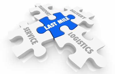
Every year, approximately 21 billion packages are delivered across the United States. If we add the 5.76 billion ride-sharing trips, every day, a staggering 74 million people and packages are delivered. These journeys all end up on a local road, with a driver navigating the last-mile and trying to park safely, legally and efficiently.
How goods, people and services get delivered in the last mile is critical.
Today, dropping off a package precisely to the doorstep requires getting to that pinpoint on a map on time. Moving from a relative understanding of a location, the centroid of a building, to the exact location of the door in a multi-building apartment complex can equate real money and resources saved at scale.
Customer satisfaction lies in the last-mile. The consumer is now conditioned for seamless, always accurate pick-up and drop-off. The ability to cut down a driver's dwell and idle time has enormous customer benefits and cost savings, including the externalities of fuel savings for sustainability and environmental efforts, to the operational efficiencies and money saved on human and monetary capital.
Navigating Today’s Last-Mile
As the delivery van, car and rideshare vehicle approaches the pickup/drop-off address, it faces a maze of hurdles, including time-based parking restrictions, curbs painted in assorted colors, bike lanes and from the Las Vegas Strip to Chicago’s Magnificent Mile to New York’s LaGuardia Airport, mandatory pick-up and drop-off zones imposed by the city or airport.
Vehicles routed to the last-mile must deal with the geometry of the world in all the relevant cities, counties, states and countries where the fleets operate.
Transportation businesses require ever-more precise data for the pick-up and drop-off points of their passenger rides, goods and food delivery.
Improving Last-Mile Delivery
Improving last-mile delivery requires an end-to-end approach and seamless coordination from the start of the journey. The last-mile starts with the handoff in digital systems and location-based services, from tour planning and how each package is bundled and allocated for multiple drivers to route optimization and the visual applications navigating drivers to their destinations.
Here are just a few factors in calibrating last-mile precision: calculating the route; optimizing the various stops; studying the historical patterns of dwell-time at this drop-off point; predicting traffic around the event two weeks down the road.
All those computing processes happen using algorithms built by transportation and fleet operators or the fleet management companies they employ. When powered by the technology engines of a modern mapping platform, these algorithms can produce marvels of ROI in more efficient fuel consumption, higher asset utilization and lower cost per delivery.
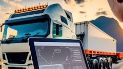
Fleet managers are bringing new tools to the driver in the UI form of a tablet or embedded or mobile application, fed with complex, granular and rich datasets: the last few meters dataset, which covers all those hurdles, helping the dispatcher and driver plan and navigate constraints.
However, such datasets are complex and costly to collect and maintain in real-time.
The Back-End Technology and Partnerships for the Last-Mile
Improving last-mile delivery requires a look under the “digital hood” of a vehicle and its back-end technology stack.
The last-mile is a big data challenge and requires ingesting new data sensor loops and best practices for data cleansing and pattern matching. For example, trucks and vans now have eyes, with safety cameras (looking inside and outside of the truck cabin) becoming increasingly common. They are also equipped with asset trackers, which are moving to ever more precise positioning fixes. Historical analysis of those movement data points helps create “heat maps” of the stop area routinely taken by a driver.
Improving last-mile delivery requires robust use of mapping and location-based services, from geocoding to route planning and optimization software to incorporating live, historical and predictive traffic information.
In this new world, “map-making” becomes a shared responsibility between the “map provider” and the fleet operator. Data collected by one can be used by the other in a virtuous circle of data exchanges, which, over time, builds out a data asset of scale and precision. The customer and tool provider truly become new partners in this data economy.
The application of artificial intelligence offers a new class of software processes, which will make their way into the T&L market from the largest players down to the mid-tier players and the mobile phone or tablet for small fleets.
Digital mapping and location-based service companies are increasing their offerings and the tools for such data partnerships, from the processing of street-level imagery, truck movement data and the advent of private map layers management. Map-making is now collaborative and must continue to be collaborative to successfully navigate the last mile.




![Pros To Know 2026 [color]](https://img.sdcexec.com/mindful/acbm/workspaces/default/uploads/2025/08/prostoknow-2026-color.mduFvhpgMk.png?ar=16%3A9&auto=format%2Ccompress&bg=fff&fill-color=fff&fit=fill&h=135&q=70&w=240)

